
 Deutsch
 English
 Español
 Français
 Italiano
 Polski
 Português
 Suomi
 Svenska
 Türkçe
 Русский
 עברית
 한국어
 中文
 日本語
The Sea That Left: A Guide to the Aral
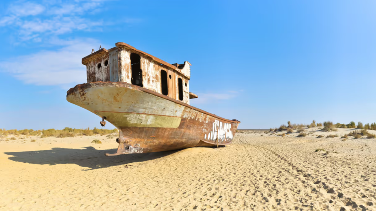
The ships in Did you know? A music festival is held among Muynak's old fishing boats Since 2018 the Stihia festival of electronic music, art and science has gathered in Muynak, once a port on the Aral Sea, right beside the ships left on the sand. It ends by burning a 10-metre installation of the word SEA. Read more → still point their bows towards the sea. They stand in a row on the sand above what was the harbour, rusted to the colour of the desert around them, and there is no water in sight in any direction. In 1960 the Did you know? Part of the Aral Sea is coming back In 2005 the 12-km Kokaral dike was completed to keep the Syr Darya's water in the North Aral Sea. The level rose faster than expected, the water grew less salty, and fish and fishing returned. Read more → covered about 68,000 square kilometres and Muynak was its fishing port. Today the drive from Muynak to the shore takes several hours across the old seabed.
We are a tour operator in Tashkent, and the Aral is the trip our guests describe most differently from the rest of Uzbekistan. It is not a beach and not a ruin. It is a landscape that shows, at ground level, what happens when a sea leaves, and what people are doing about it. Here is how it happened, what you see on the way, and how our two-day extension works.
How the sea disappeared
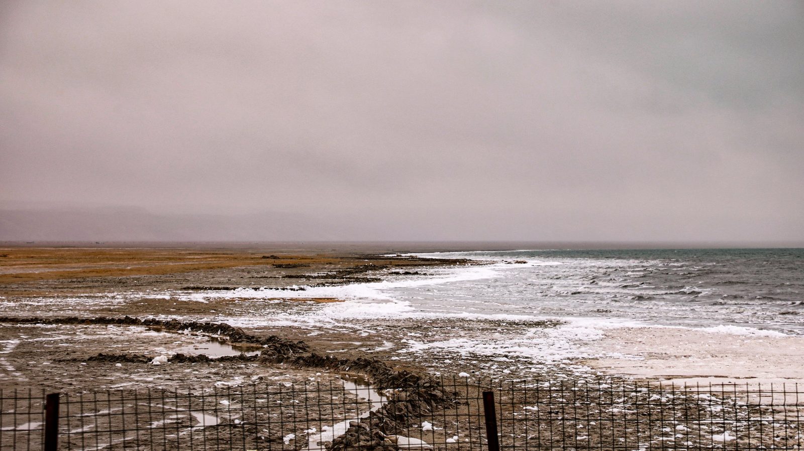
The Aral was fed by two great rivers, the Amu Darya and the Syr Darya. From the 1960s most of their water was diverted into a vast irrigation network for the cotton fields of Central Asia. The rivers kept watering the fields; the sea began to shrink. In 1987 it split into a Northern and a Southern Aral. In 2003 the Southern Aral split again into western and eastern basins, and in August 2014 satellite images showed the eastern basin completely dry for the first time.
The exposed seabed became a new desert, the .Did you know? The Aralkum is the youngest desert in the world As the Aral Sea shrank, its dry bed turned into a new desert, the Aralkum, which has appeared since 1960. It is called the youngest desert in the world, and the old fishing boats of Muynak now stand on its edge. Read more → It is salty, and on windy days dust storms lift that salt into the air. At its peak the Aral fishing industry employed about 40,000 people; commercial fishing ended by 1987.
Muynak: the ship cemetery and the museum
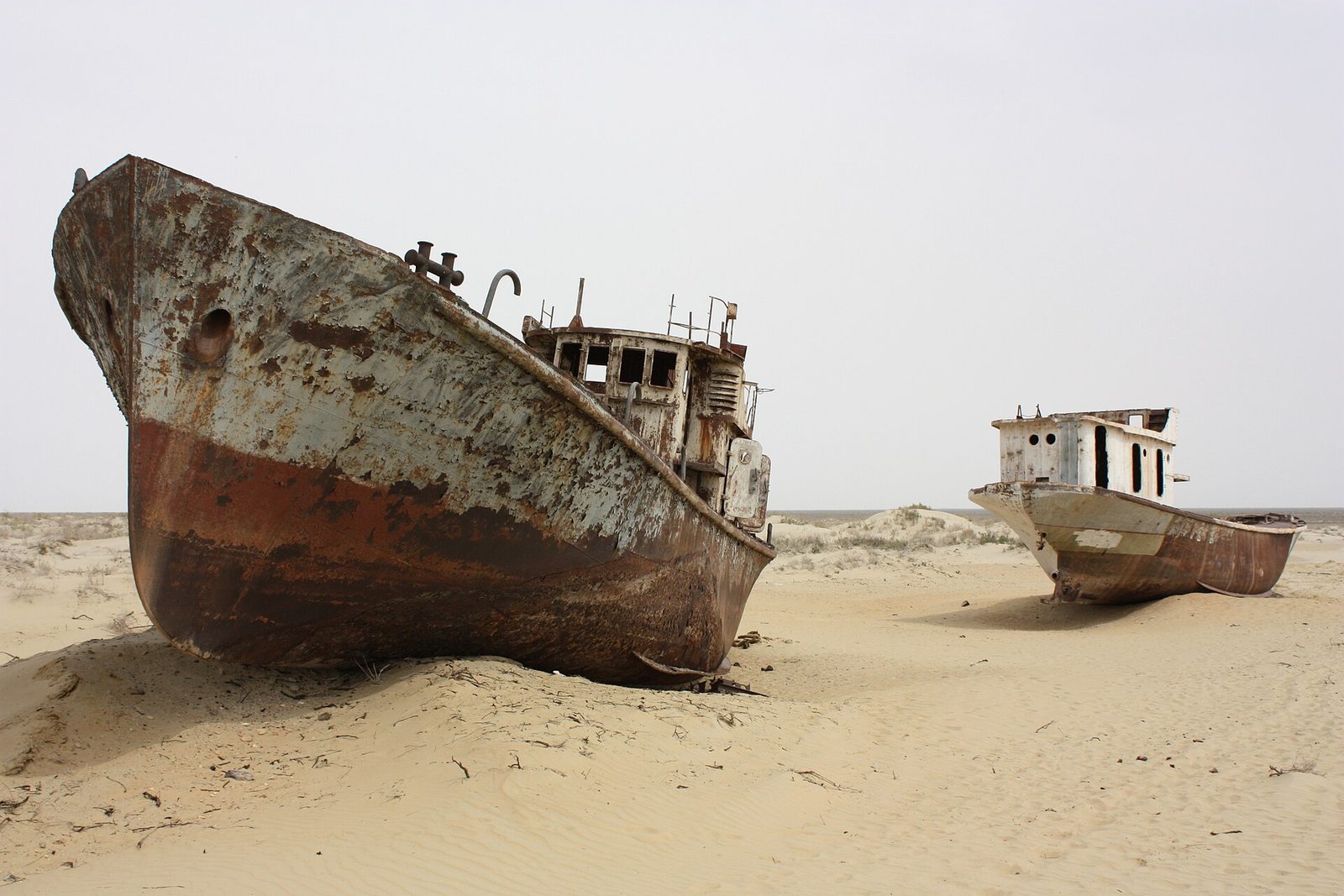
The rusting fishing boats on the old shoreline are the picture everyone knows, and standing among them is still a strong moment. But the key to the place is the small museum in the town. Its black-and-white photographs of the working port, its fishing records and its map of the shoreline retreating decade by decade turn a striking view into something you understand. We always suggest seeing the ships first and the museum second.
Muynak has also found a new kind of life: since 2018 the town has hosted Stihia, an electronic music festival held right by the ship graveyard to draw attention to the Aral. It is a sign that the region has not simply closed down and waited.
A forest planted on the seabed
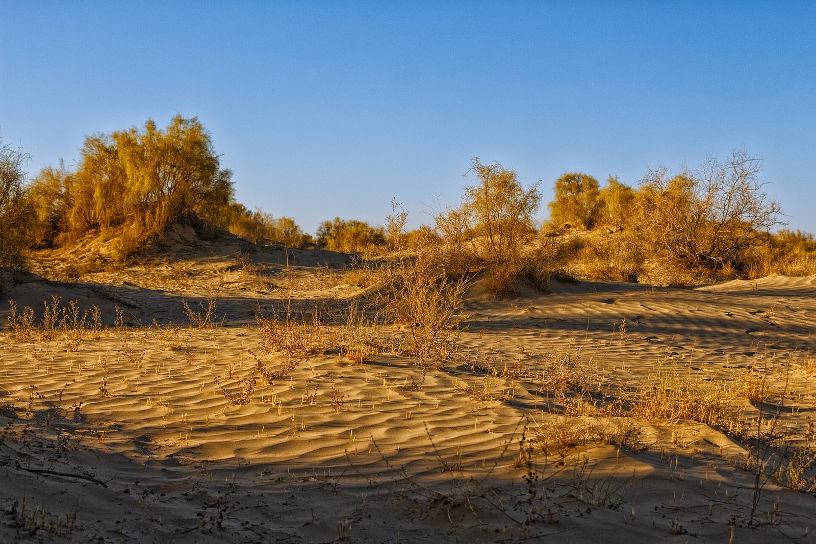
Beyond Muynak the road runs over the former bottom of the sea, and here begins the part of the story that rarely makes the photographs. On the dried seabed people plant saxaul, a tough desert tree that holds sand with its roots and needs almost no water, to stop the salt and dust from blowing. In March 2025 a project backed by UNDP planted 80,000 saxaul seedlings on 80 hectares in Muynak district, and in early 2026 a new campaign began to plant another 90,000 seedlings.
A young plantation looks modest: low grey-green shrubs, far apart. But it grows on what used to be sea, and each shrub holds down sand that would otherwise rise with the wind.
The Ustyurt plateau and a night by the water
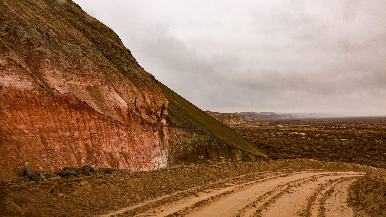
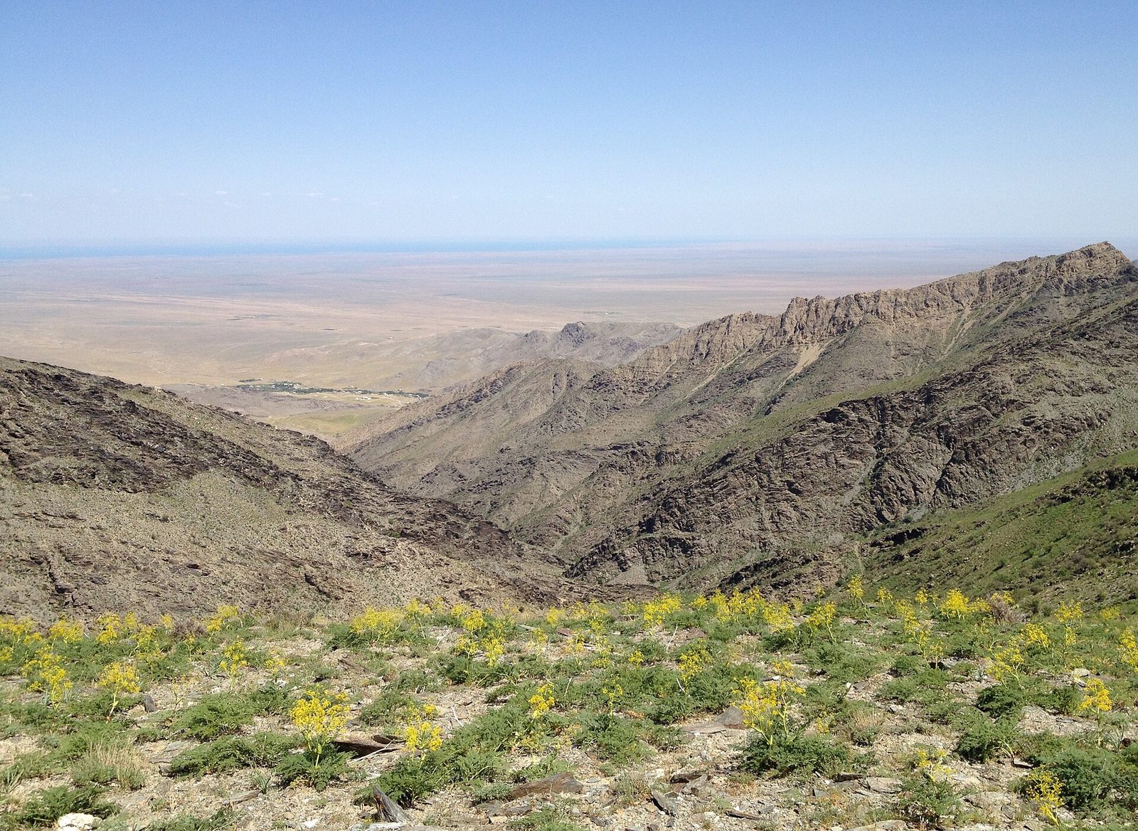
On the way to the shore the route climbs onto the ,Did you know? Giant stone “arrows” on the Ustyurt plateau were hunting traps Along the Ustyurt cliffs run low stone walls called arans, laid out as arrows, triangles and even stars. Saiga and gazelles run along a wall rather than over it, so hunters steered herds into pens. They were used from the Bronze Age on. Read more → a limestone plateau that breaks off in steep cliffs where it meets the old seabed. There are no towns and no green valleys here, only a flat upland cut by canyons that look almost lunar in the low evening light. It is one of the quietest places in Uzbekistan: no road noise, no crowds, nothing built for many kilometres.
The night is spent in a camp by the water. In the morning the walk down to the shore takes longer than it looks from above. The water of the Southern Aral is very salty, and the shore is grey and firm, in places crusted white with salt. For most of our guests this quiet morning is the reason they came.
Where the water is coming back
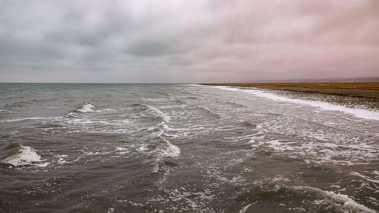
The Southern Aral will not return to what it was: the Amu Darya rarely reaches it now. In the north the story is different. In 2005 the Kokaral dam was completed, separating the Northern Aral from the southern part. Within three years the water level in the north rose by about 12 metres, the salinity fell from about 30 to 8 grams per litre, and freshwater fish came back. The Northern Aral shows that part of a sea can be returned when the water is kept.
Sudochie Lake and Mizdakhan on the way back
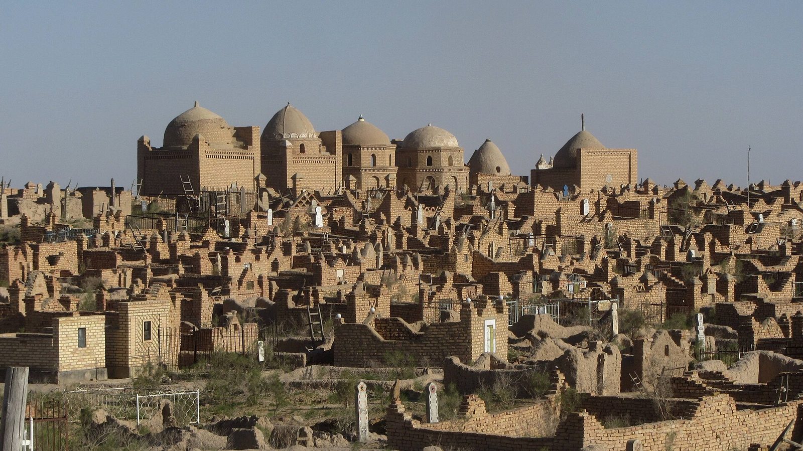
The return route crosses the plateau again and stops at Sudochie Lake, a wetland where about half of the region's roughly 230 bird species breed. The last stop before Nukus is ,Did you know? Legend says Mizdakhan's little brick towers grant wishes Legend says that if you stack a column of seven bricks at the Mizdakhan necropolis near Nukus, your wish comes true; another tale says each column adds seven years to the life of the world. The hill site holds ruins from many centuries. Read more → an active historic necropolis on low hills near Khojeyli, with the ruins of the ancient town of Did you know? Shells from the Indian Ocean were found near Nukus Gyaur-Kala near Mizdakhan, a Khorezm fortress of the 4th century BC with walls about 10 m high, stood on a branch of the Silk Road. Finds there include coral beads, Indian Ocean shells and fabrics woven with gold thread. Read more → and mausoleums built over many centuries. As at any cemetery in use, visitors walk quietly and dress modestly.
Nukus and the Savitsky Museum
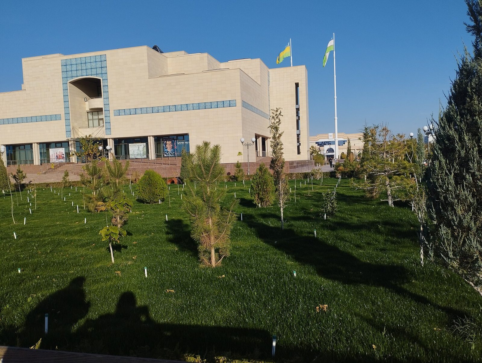
Nukus, the capital of Karakalpakstan, is where the trip begins and ends, and it holds one of the great surprises of Central Asia. The State Museum of Art named after Did you know? A 2010 film tells how Savitsky gathered his collection A 2010 documentary follows Igor Savitsky as he sought out avant-garde painters whose works were not shown in museums in those years, met their families and brought thousands of works to Nukus. Ben Kingsley voices Savitsky. Read more → keeps around 100,000 exhibits, including one of the largest collections of Soviet avant-garde art anywhere, gathered by Savitsky over decades, alongside Did you know? Karakalpak means 'black hat' The Karakalpaks, who gave Karakalpakstan its name, call themselves Qaraqalpaq: qara means black and qalpaq a hat. About 770,000 of the world's 900,000 Karakalpaks live in the republic, whose capital is Nukus. Read more → jewellery, costume and archaeology. If your flight allows, give it a few hours before or after the Aral. Our article on the Savitsky Museum explains what to see.
How our Aral extension works
The Aral is reached as an extension to a longer route, usually added to Samarkand, Bukhara and Khiva. Our Aral Sea extension takes two days. Day 1: morning flight from Tashkent to Nukus, then by 4×4 to Muynak and the ship cemetery, across the Ustyurt plateau to the shore, and the night in a camp by the water. Day 2: back across the plateau with stops at Sudochie Lake and Mizdakhan, then Nukus and the evening flight to Tashkent. The domestic flights, the 4×4, the camp night and a guide in your language are included; the details and dates are on the tour page.
The best seasons are spring (April–May) and autumn (September–October). Summer on the open seabed is very hot, with no shade, and even in spring and autumn the difference between day and night is sharp, so bring a warm layer as well as a hat, sunglasses and sunscreen. Mobile coverage on the plateau is weak or absent. If you want more time in the region, with the desert fortresses of Khorezm, see our Karakalpakstan and Khorezm fortresses tour and our Karakalpakstan travel guide.
In short
- In 1960 the Aral covered about 68,000 km²; diverted rivers split it in 1987, and the eastern basin of the Southern Aral was dry by 2014.
- Muynak's ships and its small museum explain the story best; see the ships first, the museum second.
- Saxaul is being planted on the dried seabed to hold the sand and salt; in the north, the Kokaral dam has brought water and fish back.
- Our two-day extension flies to Nukus and runs by 4×4 to Muynak, the Ustyurt and a night by the water, returning via Sudochie Lake and Mizdakhan.
- Go in April–May or September–October, and pack for both heat and cold.
© Photos
- Ship cemetery, Muynak — Arian Zwegers / Wikimedia Commons · CC BY 2.0
- Desert shrubs on the sands of the Aralkum, the former bed of the Aral Sea, at sunrise, Muynak district — NatalieChunina / Wikimedia Commons · CC BY-SA 4.0
- Mizdakhan necropolis near Nukus — Erik Albers / Wikimedia Commons · CC BY-SA 4.0