
 Deutsch
 English
 Español
 Français
 Italiano
 Polski
 Português
 Suomi
 Svenska
 Türkçe
 Русский
 עברית
 한국어
 中文
 日本語
Places in this article: Samarkand · Bukhara
What Was the Silk Road, and Why Does Uzbekistan Call Itself Its Heart
On the highway between Navoi and Bukhara, the car stops in the middle of the steppe. On one side stands a tall brick portal; on the other, a low dome sits right on the ground. The portal is what remains of ,Did you know? Legend says a nomad chief built Rabat-i Malik Local tradition, recorded by a traveller in the 19th century, remembered the ruin as the castle of a khan and his heirs, built by a nomad chief called Malik Khan. What is known: the Karakhanids raised it around 1078–1079 on the road from Bukhara. Read more → an 11th-century caravanserai. The dome is a ,Did you know? A domed cistern by Rabat-i Malik is named “cold water” Across the road from Rabat-i Malik stands the Malik sardoba, a covered cistern of the same period; the Persian name means “cold water”. An underground channel brought water from the Zarafshan, and steps lead more than 10 m down under the dome. Read more → a covered water cistern. You walk down the steps into the cool dark and understand the main thing at once: nobody stopped here for the view. They stopped to refill, water the animals and sleep behind a wall.
Seen this way, the A network of caravan routes between China and the Mediterranean. Samarkand, Bukhara and Khiva grew rich as stops along it. looks less like a romantic legend and more like a logistics network, with warehouses, watering points, money-changers and competitors. Uzbekistan calls itself its heart for a practical reason: almost every cargo going from China to the west, or back, passed through these oases. And none of the people who led the caravans ever heard the name.
We are a tour operator in Tashkent, and we still move people through the same oases, by train instead of by camel. Here is what the Silk Road actually was, why it ran through Uzbekistan, and where you can see it today.
A name invented after the caravans had gone
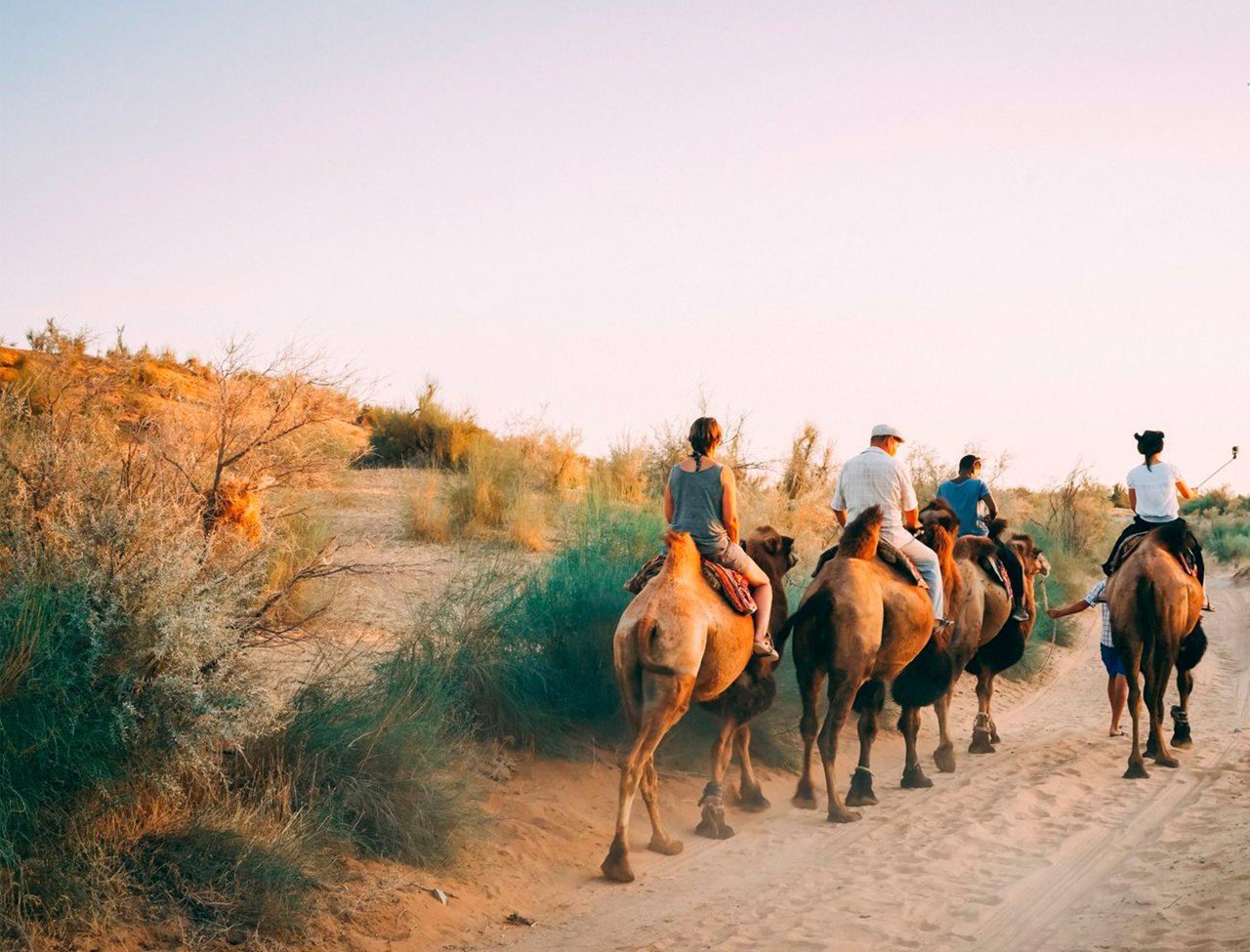
The term «Silk Road» was coined by the German geographer Ferdinand von Richthofen in 1877, when caravan trade had long been in decline. Merchants and drivers talked about the road to a particular city, the next well, the next market. There was no single road: there was a web of routes that shifted with wars, droughts and tolls.
Silk gave the web its pretty name, but the bills of lading listed much more. Westward went spices, glass, paper, precious stones and later gunpowder; eastward went wool, gold and horses. Ideas travelled the same routes. Buddhism reached China along them, and Islam later moved east along the same roads.
The cargo that changed the world more than silk
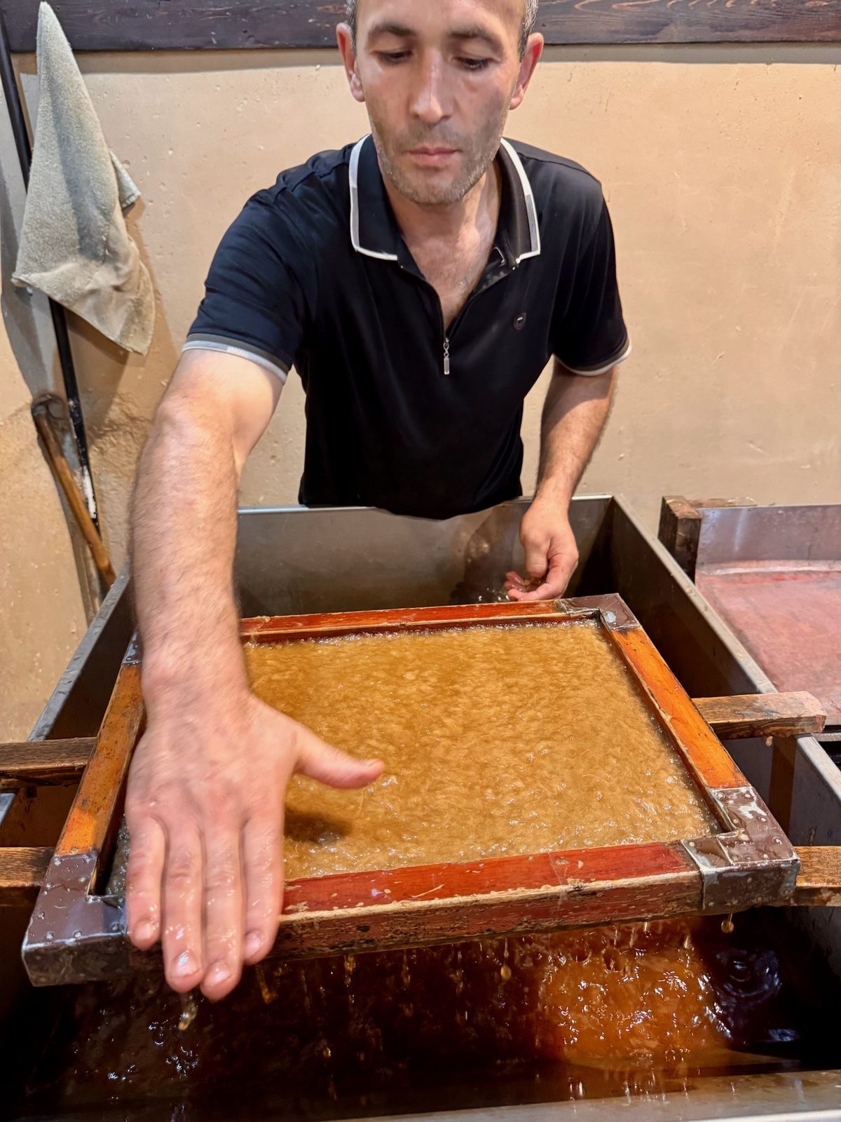
The most important thing carried along these roads may have been a technology rather than a product. Paper was invented in China and reached the Islamic world through Samarkand. A well-known story says the secret came with Chinese craftsmen who ended up in Samarkand after the Battle of Talas in 751. Historians treat it as a good legend, since paper was probably known in the region earlier. What nobody disputes is that «»Did you know? Legend says Chinese prisoners taught Samarkand paper A legend recorded in the 11th century says Chinese prisoners taken at the Battle of Talas in 751 taught Samarkand to make paper. In fact paper was used here earlier, and the craft most likely came gradually along the Silk Road. Read more → became a famous product, and through the Islamic world paper later reached Europe.
You can watch it being made today, from mulberry bark to polished sheet, at the mill in A village near Samarkand where paper is made by hand from mulberry bark, the old way, at a working mill on the stream. just outside Samarkand: our page on Samarkand paper explains the process.
Why everything passed through here
Geography gave the answer. To the east rise the Did you know? The tulip's family tree is said to begin in the Tien Shan Long before Ottoman gardens and Dutch bulb fields, wild tulips grew in Central Asia's mountains, and the Tien Shan is often named as their homeland. In April they flower on the slopes around Chimgan. Read more → and the Pamirs; to the west and north lie the The Kyzylkum, or Red Sands: the desert between the Amu Darya and Syr Darya rivers that the road and the railway cross on the way to Khiva. and Karakum deserts. There are only a few passages a loaded caravan can take, and the oases of Uzbekistan sat on the main ones: Samarkand and Bukhara on the Zarafshan, Khiva in the delta of the Amu Darya, Termez at a crossing of the Amu Darya in the south.
A caravan needed a stop every few days: water, fodder, repairs, a market, protection. In the desert such points are not chosen; water dictates them. That is why the same cities stayed transit hubs for centuries while the empires around them changed.
In 2023 UNESCO inscribed one stretch of the network as World Heritage: «Silk Roads: Zarafshan–Karakum Corridor», shared with Tajikistan and Turkmenistan. Its value is not palaces but infrastructure: ancient towns, mosques, caravanserais. Rabat-i Malik and its sardoba are part of the Uzbek section; the full list is in our guide to Uzbekistan's UNESCO sites.
Samarkand: the showroom
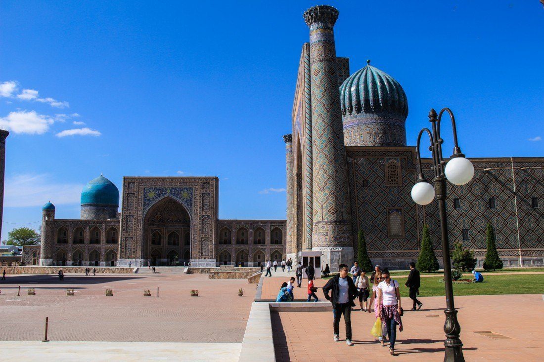
Samarkand stood where the routes from China, India and Persia met, and it grew rich on what passed through. When Amir Timur (Tamerlane, 1336–1405), founder of the Timurid empire, which had its capital in Samarkand. Born near Shahrisabz. Read more → chose it as his capital in the 14th century, he took a city already known to every merchant in Asia. The ,Did you know? 95 elephants hauled stone for Timur's great mosque Bibi-Khanym, begun in 1399 after Timur took Delhi, was the largest mosque of his empire. Some 200 stonecutters worked on site and 95 elephants brought from India hauled the loads; the courtyard was meant to hold 10,000 people. Read more → Did you know? Timur's tombstone went to Persia and came back The dark-green jade slab on Timur's grave in Gur-e-Amir was carried off by Nader Shah in 1740. It broke, and on his advisers' urging he sent it back to Samarkand. Read more → and the madrasahs of the Did you know? The Registan's sun-carrying lion went on a banknote The Sher-Dor Madrasah (1619–1636) is named for the big cats with the sun on their backs on its portal. The image appeared on the reverse of Uzbekistan's 200-som note of 1997. Read more → were, in effect, the representative buildings of a trading power, built partly so that every passing caravan would carry away a story of the city's wealth.
Look at the Registan through the eyes of a 15th-century merchant, and it did the job that skyscrapers do in financial capitals today: it showed that the money was here. More on how the square grew is in our page on the Registan.
Bukhara: the back office
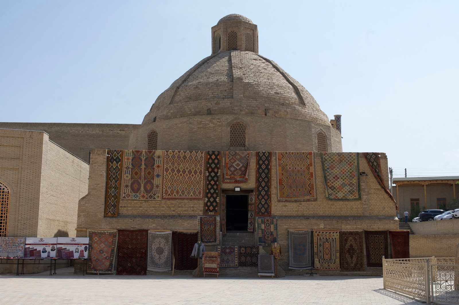
Bukhara took another niche. It was a city of money and learning, not only a market. Money-changers worked here, madrasahs stood here, scholars lived here and students came here.
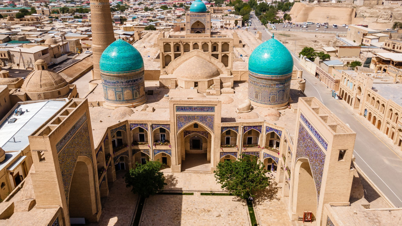
You see it best in the Did you know? Under Bukhara's domes merchants changed money and gold Four 16th-century trading domes still stand over old crossroads. Toki Sarrafon was the money changers' dome, where merchants from India and China swapped coins; Toki Zargaron held jewellers' workshops, Toki Telpak Furushon sold caps. Read more → that survive in the centre of the old town. They were built in the 16th century, and each had its trade. Toki Sarrafon was the dome of the money-changers, where coins of one state were exchanged for those of another. Toki Zargaron was the dome of the jewellers, Toki Telpak Furushon that of the hat-sellers. The domes stand over street crossings, so you walk under them simply by walking through town. People still trade beneath them, though in souvenirs rather than coins.
What brought it to an end
The land route lost the competition. In 1498 Vasco da Gama reached India by sea, and in the 16th century ships began to carry goods more cheaply and safely than a caravan travelling for months. At about the same time, the political unity the Mongol state had once given the region broke up for good. The roads were cut into separate realms, with more tolls and more risks.
Central Asia stopped being the fastest way between Europe and Asia. The caravanserais emptied, and the portal of Rabat-i Malik was left standing by a road where lorries now drive.
Where to see the Silk Road today
The trading domes of Bukhara, the Registan and the Samarkand's main bazaar, right next to Bibi-Khanym: Samarkand bread, dried fruit, nuts and halva. Read more → in Samarkand, Rabat-i Malik and the sardoba on the Navoi–Bukhara road. Rabat-i Malik is easy to add if you travel between Samarkand and Bukhara by car rather than by train, for example with our private transfer from Samarkand: tell us where you would like to stop. The stops on the way are in Samarkand to Bukhara.
If you want the whole road as a theme, see our Silk Road tours in Uzbekistan, from the Silk Road on foot and by rail in ten days to the 23-day Silk Road tour across five Central Asian countries.
In short
- The «Silk Road» was a web of caravan routes, named only in 1877; silk was just the prettiest word on the bill of lading. Paper, ideas and faiths travelled the same roads.
- Uzbekistan sat on the few passages between mountains and deserts: Samarkand and Bukhara on the Zarafshan, Khiva on the Amu Darya delta, Termez at the river crossing.
- Samarkand was the showroom, Bukhara the back office: see the Registan, then walk under the trading domes.
- Stop at Rabat-i Malik and its sardoba if you drive between Samarkand and Bukhara.
- Come in April–May or September–October; in summer the caravan cities live up to their reputation for heat. Read on: a short history of Uzbekistan.